
CATF publishes interactive map of superhot rock projects

The Clean Air Task Force has published the Superhot Rock Project Map, a web-based interactive map consolidating the superhot rock projects around the world.
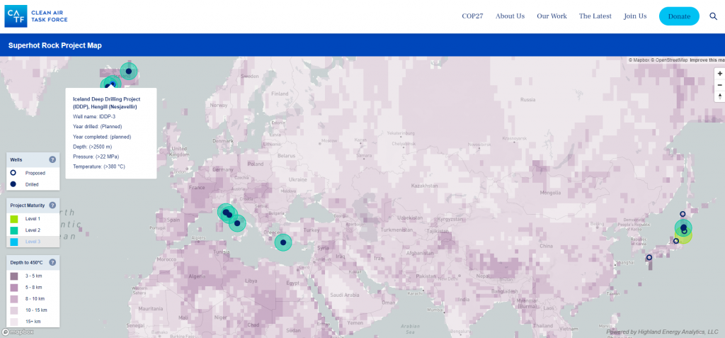
The Clean Air Task Force (CATF) has published the Superhot Rock Project Map, a web-based interactive map that highlights superhot rock projects and shows the estimated depth to reach a temperature of 450 degrees Celsius across the world. The map also shows the level of maturity of existing superhot rock projects with links to detailed factsheets for select projects.
It was less than a month ago when the CATF published the detailed study “Superhot Rock Energy: A Vision for Firm, Global Zero-Carbon Energy” detailing the potential, initiatives, and challenges of extracting geothermal energy from superhot rock systems. These are systems with temperatures of over 400 degrees Celsius, typically occurring in deeper dry rock systems.
In a piece accompanying the interactive map, the CATF states that superhot rock projects are still on the early stages of development. Of the fourteen completed superhot rock projects considered in the map, all are classified as Level 2 – they have drilled down to superhot rock, but no power plant has been established to turn the heat to power.
Nevertheless, learnings from the Level 2 projects will inform the Level 1 projects, or the projects under planning. There are nine such projects indicated in the map.
Source: CATF