The international oil, gas, and chemicals company OMV Group and ZeroGeo Energy GmbH are conducting a geothermal exploration project called Projekt THERMO in the Lower Saxony state of Germany. The project aims to generate geothermal power with a potential by-product of heat production to provide always-on green electricity for Lower Saxony’s economy.
The survey will take place over two weeks over November 2022 and a live tracker page on the project’s website will provide daily updates on the flight programme.
We had previously reported on the efforts of Vienna, Austria-based OMV Group to pivot from oil and gas production to geothermal energy and carbon capture and storage assets.
The sedimentary basins beneath Lower Saxony have long been known to have higher than average geothermal gradients and provide the ideal characteristics for generating geothermal heat and power with the latest geothermal technologies, notably closed-loop systems. The area being examined is particularly suitable for geothermal energy, as the heat is closer to the surface than in many parts of Germany.

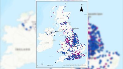
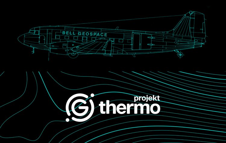
To determine the best possible areas for geothermal energy, a geophysical survey will be conducted. The type of survey that will be done for Projekt THERMO is called an Air – Full Tensor Gravity (AIR-FTG) and magnetics survey. This will involve flying a small aircraft over an area covering 5000 square kilometers to the north and north-east of Hanover. It is provided by Bell Geospace Limited, an experienced company which has been operating these advanced geophysical surveys since 1994 with an unblemished safety record.
The proposed flight altitude is 80 – 300m above ground for optimal retrieval of signal and to accommodate safe flying over built up areas. The aircraft is not taking any pictures or video recording – instead, it is taking high resolution gravity and magnetic readings in order to create a geological map of the area.
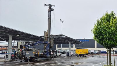
Once the data from the airborne surveys have been processed and analyzed, the team will decide on the next phase of Projekt Thermo. This may involve a 3D seismic survey and/or exploratory drilling. Any subsequent phases of exploration will be conducted in accordance with all relevant permits and regulations and the Company will provide regular updates as to its plans and intentions.
Projekt THERMO will be donating the cost of their carbon emissions (from transport and survey, calculated from the EU’s carbon price) to a local biodiversity project run by NABU Niedersachsen.
Source: Projekt Thermo and OMV Group