An interesting article in UAS Weekly, the industry outlet for Unmanned Aerial Systems and Drone industry news and information, shares details on efforts in geothermal exploration in Nevada, U.S.
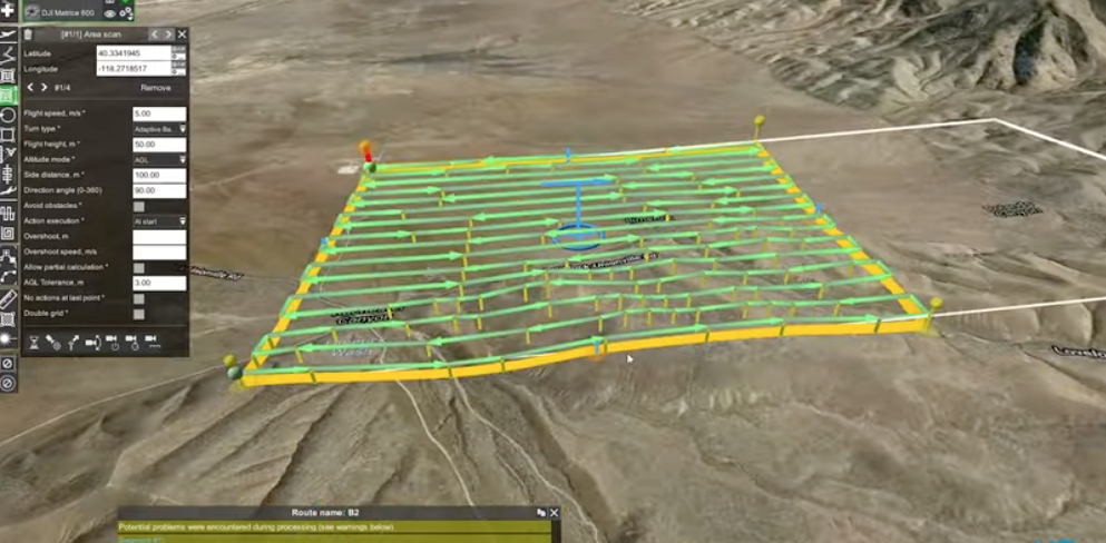
The article and the accompanying video, look hat how a group by the University of Nevada in Reno, is engaging on exploring blind geothermal systems with unmanned aerial vehicle (UAV) magnetometry. The site for the study is in the Humboldt Range in Nevada.
The target with the UAV magnetometry is to reveal buried fault and boundaries of different rock types that provide clues to where geothermal fluid pathways are located. A ground magnetics surveyor can hike 15-20 km per day on flat terrain. The drone based survey approach allows a two-person team to cover between 60-200 line-kilometers per day.
The survey builds on the Nevada geothermal fairway analysis project that was funded by the Geothermal Technologies Office by the U.S. Department of Energy. It was conducted by the Great Basin Center for Geothermal Energy at the University of Nevada, Reno.
Check out for details via the video or the link below.
Source: UAS Weekly