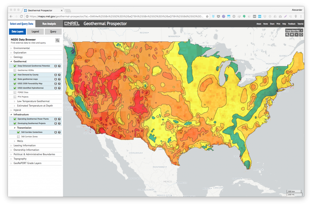
The National Renewable Energy Laboratory’s Geothermal Prospector provides a huge amount of information about geothermal energy in the United States.
The interactive map includes:
- Known geothermal resource areas and exploration regions
- State geothermal maps
- Geothermal potential for enhanced geothermal systems (EGS)
- Low-temperature geothermal resources
- Identified hydrothermal sites
- Great Basin hot spring and well analyses
- Geological map of the United States, including detailed maps for some states
- FORGE project sites
- Geothermal infrastructure – plants in operation and development, transmission infrastructure, and wells
- Geothermal leasing information
- Solar power information for those interested in hybrid solar-geothermal plants.
The map also includes a large number of other layers, including U.S. volcanoes, Phanerozoic metamorphism, major lakes and rivers, political and administrative boundaries, and many environmental features (brackish groundwater, wastewater, cooling tower blowdown, wilderness areas, Prairie Chicken distribution, areas of critical environmental concern, etc.).
All of the layers can be downloaded for further use and analysis.
Click here to access the NREL Geothermal Prospector.
Source: American GeoSciences