Geoscience BC in British Columbia/ Canada has released results of a pilot study which demonstrates the use of publicly-available regional airborne magnetic data as a geothermal exploration prospecting tool for British Columbia.
The report is now available through Geoscience BC’s website or its Earth Science Viewer.
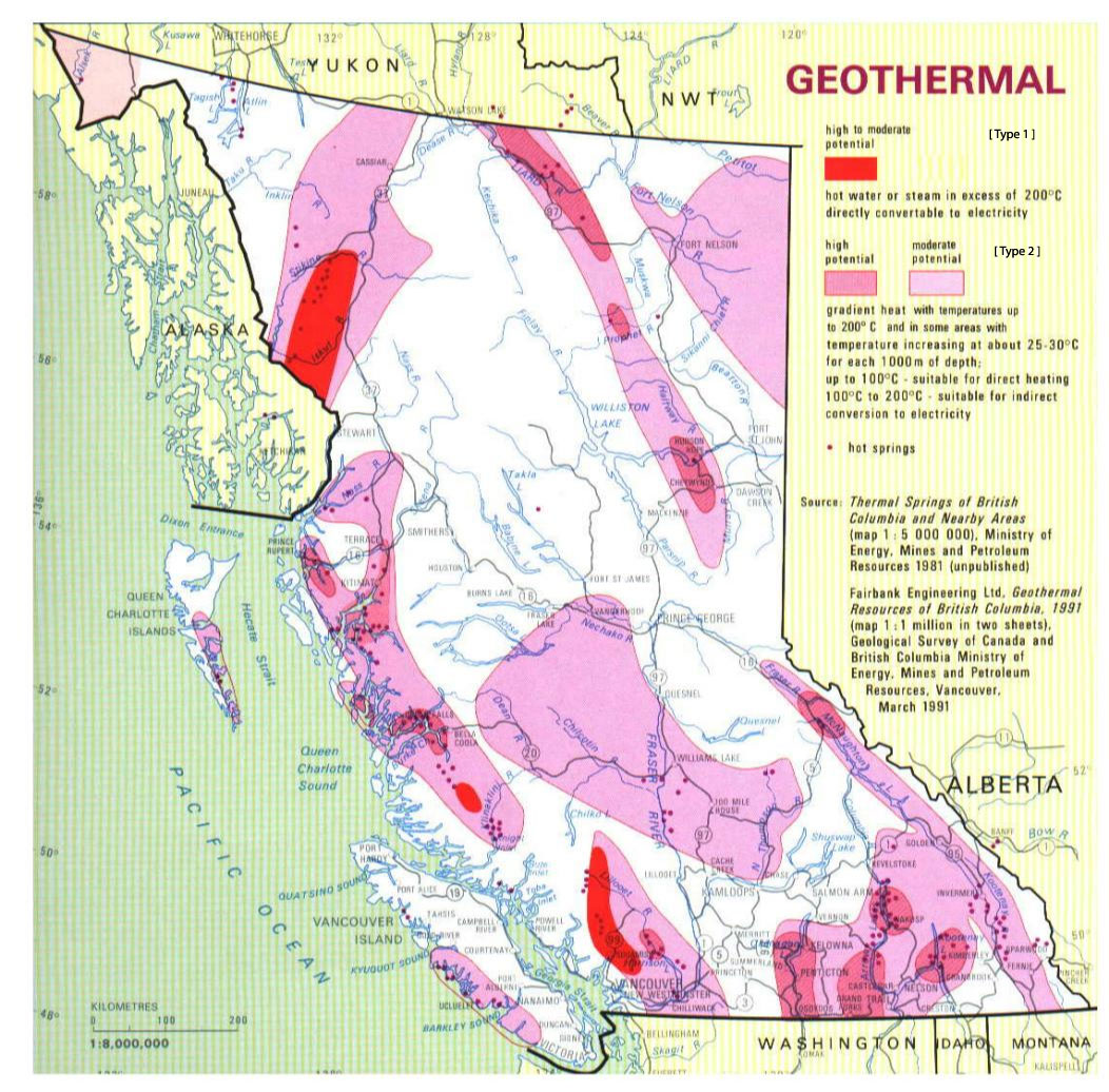
The Curie Point Depth Mapping Pilot Study in Northwest British Columbia (Geoscience BC Report 2016-14) presents a Curie point depth mapping pilot study over a small area of northwestern British Columbia. Curie point depth mapping uses regional-scale magnetic survey data to map the depth in the Earth’s crust where magnetization disappears. When used in combination with other data (e.g. heat flow) it can be used as a regional-scale geothermal prospecting tool.
In the report results are compared with the BC heat flow map, known volcanism, hot springs and regional geology. Based on the results, the authors recommend using the Curie point depth mapping technique across BC to help guide geothermal exploration programs.
Geoscience BC is a non-profit organization that receives funding from the provincial government of British Columbia/ Canada. Its mandate is to attract mineral and oil & gas investment to British Columbia through generating, interpreting and publicly distributing geoscience data in collaboration with First Nations, communities, governments and industry.
Source: Geoscience BC