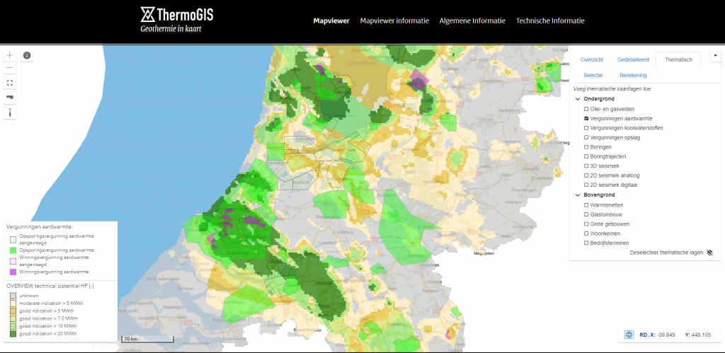
ThermoGIS, the publicly accessible web-based geographic information system that shows the regional potential of geothermal energy in the Netherlands, has been updated to version 2.2.
The developers have stated the following major changes that come with the new version:
- Streamlined and more transparent calculation method of the aquifer properties. Although this does not change the national trends of the properties, the predictions are more reliable.
- Calculation of the net-gross ratios and porosity of the aquifers using Machine Learming techniques (previously fixed net-gross ratios were assumed per aquifer, now these are calculated)
- In the Mapviewer , the used drilling data can be projected over the maps of porosity, permeability and net-gross. These are clickable to see the value;
- The technical descriptions of Aquifers , Aquifer Properties and the Calculation Model have been updated and expanded;
- The Brussels Zand Laagpakket has been completely re-mapped;
- Adjustment of the ‘look and feel’ of the website.
ThermoGIS was developed by the Geological Survey of the Netherlands , part of TNO (GDN-TNO). First published in 2010, the main goal of ThermoGIS is to support businesses and governments in developing geothermal heat extraction from the Dutch subsurface. It translates geological data and knowledge into a model of the subsurface and shows maps of the depth, thickness, permeability and temperature of rock strata from which geothermal heat may be extracted.
Source: ThermoGIS