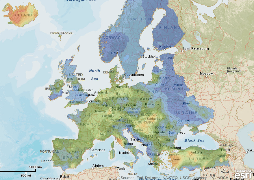
GeoLec releases a geographical information system showing for the first time ever a geothermal resource assessment from 1km to 5km depth. Based on currently available information, it shows the estimated potential for geothermal electricity production in 2020 and 2050 in each of the EU-28 Member States, plus Norway, Iceland, Switzerland, and Turkey.
The GEOELEC project, co-funded by the Intelligent Energy Europe Programme of the EU, aims at promoting geothermal electricity generation in the EU and aims at removing notably financial and regulatory barriers.
The system can be found here.
Source: EGEC announcement